Huerfano County's Black Hills
 |
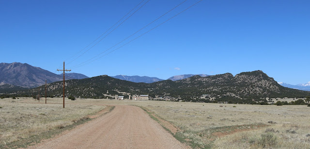
| Approaching the Black Hills from the east on Huerfano County Road 521. The buildings are what's left of Alamo, Colorado. |
For most of us, the U.S. state that comes to mind when
someone mentions a place called "Black Hills" is not Colorado.
However, there is a place here in Colorado called " Black Hills," and
it's right here in Huerfano County. In fact, there are two places in the county with
this name.
Both are small mountain ranges just south of State Highway 69
and near County Road 520. The larger, called just Black Hills, has a top
elevation of 7,493 feet. The Black Hills is also the site of Alamo, now a ghost town and location of a former coal mine.
To the north is an even smaller group of hills called Little
Black Hills. Here the highest point looks to be 7,025 feet. The Little Black
Hills are just south of Badito, near where State Highway 69 meets County Road
520.
The dark vegetation on both areas of hills, chiefly juniper
bushes, contrasts sharply with the blonde-colored grasses covering the surrounding
flat plains, thus the names.
Both the Black Hills and the Little Black Hills are volcanic in origin and may be an extension of Greenhorn Mountain to the north
Both the Black Hills and the Little Black Hills are volcanic in origin and may be an extension of Greenhorn Mountain to the north


Comments
Post a Comment