Cuchara Mountain Park
 |
The Cuchara Mountain Park entrance. The entrance gate is new, and not a leftover from the ski resort. I imagine they will eventually hang a sign from the top horizontal log.
|
I drove over to Cuchara Mountain Park. The park is a former ski resort that's being re-purposed. No one was around, so I let myself in and walked around.
 |
The center of the park showing Lift 3 and a former ski run. The elevation at the top
of the apparently unnamed mountain is 10,807 feet. Somewhere between the bottom of the lift and the top of the mountain is where county park property ends
and the San Carlos Ranger District of the San Isabel National Forest begins.
|
The park is south of Cuchara and west of Highway 12. To get there, you take Panadero Avenue about a half mile west — uphill — to the park entrance. It's a washboarded dirt road with lots of four- and five-inch rocks all over it. There are signs that state the name of the park at the intersections, but they are ambiguous because they lack arrows.
The park is now owned by Huerfano County, so it's a county park, apparently the first one for our county.
 |
| A topo map of the area. Colorado State Highway 12 is the red highway at far right. The map doesn't show the connection between Panadero Avenue and the highway; this is a map error. |
Baker Creek — a tributary of the Cuchara River — flows down the mountain and through the center of the park. It's a gurgling mountain stream. Now I understand the origin of the name "Panadero Avenue." Baker in Spanish is panadero. According to Colorado Ski History, the name of the Cuchara Valley Ski Resort when it first opened in 1981 was Panadero. Someone cleverly translated Baker into Spanish and gave the resulting name to the resort and its access road.
 |
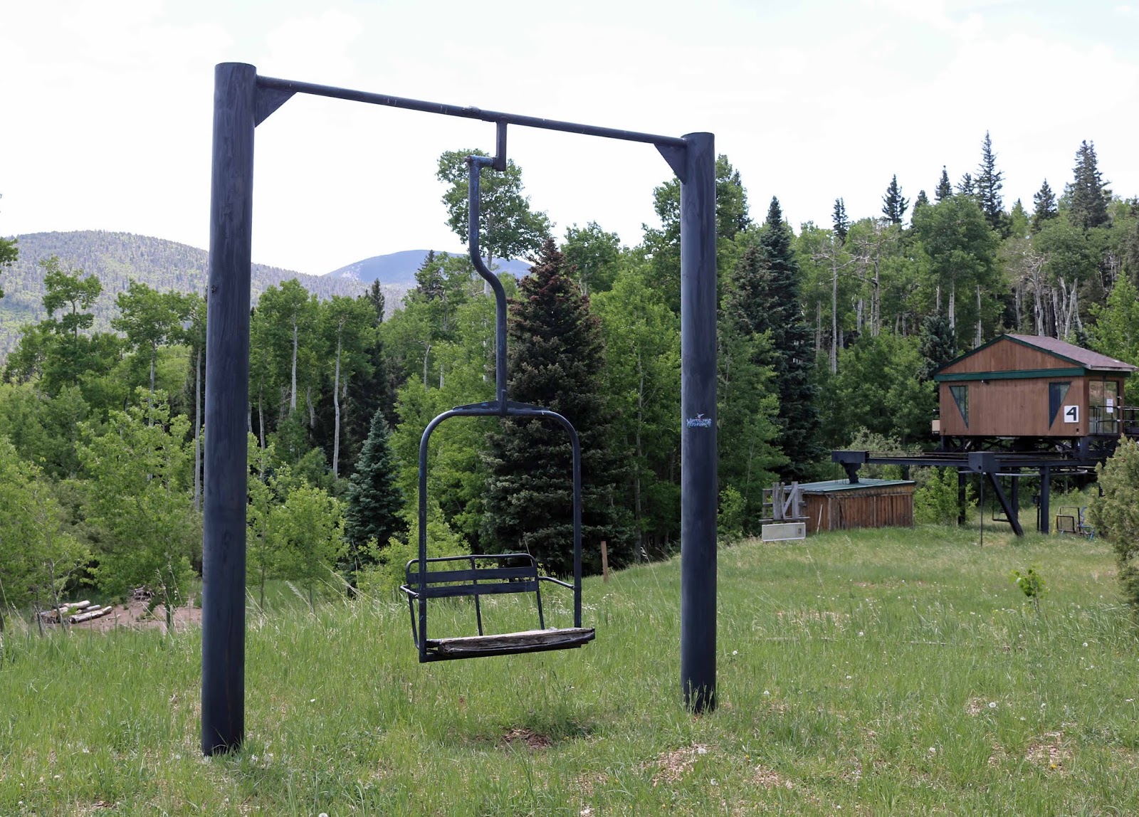
| This is lift 4, just to the left (south) of lift 3. |
 |
| A unique style of park bench. |
This is the park's logo, and it appears on the signs on Panadero Avenue as you approach the park.
|
The park is still being developed. It is a great project and will benefit the citizens of and visitors to Huerfano County. Congratulations to the Cuchara Foundation for this worthy effort.
The next time I visit the park, I think I would like to hike to the top of the mountain and shoot some pictures of the three mountains across the valley (the White mountains).


Comments
Post a Comment